
We all know how easy it is to get lost in a new city, especially Waterloo. Some of us are still getting lost after being here for a few years. This is why we've included this page, it contains some of the more important maps you will need to get around.
|
Check out some of the other places on campus such as:
|
 |
|
If you get a chance to come back check out what else Waterloo has to offer, such as:
|
 |
|
If you get a chance to come back check out what else Kitchener has to offer, such as:
|
 |
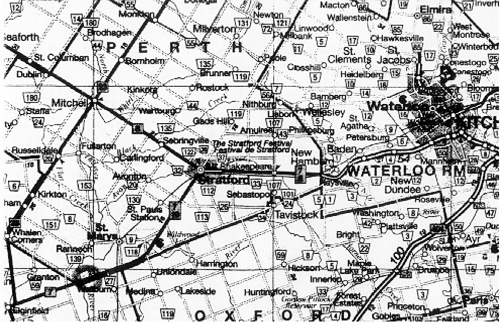
Map to Hill
Here is a map to the race hill, located off of highway 7 just south of St. Marys. Sorry the map isn't super clear - from Waterloo take hwy. 7 (off hwy. 86) west until you see the signs for the River Valley Country Club. That's it.
We have also provided links so you can check out the weather conditions in Waterloo.
- The University has it's own Weather Server, check it out
- And just to double check, why not go to the The Weather Network